Snow survey in the Soddie Watershed 2008
March 14, 2008 – 1:47 pm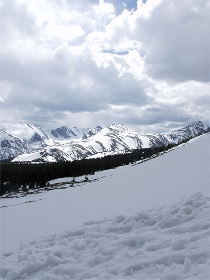
I’m gearing up to do a snow survey at my field site, the Soddie Watershed (shown above). The Soddie Watershed is a 0.89 km2 alpine-subalpine catchment on the south side of Niwot Ridge. Niwot Ridge is a large swath of alpine tundra adjacent to the continental divide in the Front Range of the Rocky Mountains.
The goal of the survey is to measure the spatial patterns in snow depth across the whole watershed in order to understand patterns of snow distribution. Understanding snow distribution will help me to understand an underlying pattern that is central to my dissertation: the spatial heterogeneity in nitrogen inputs that build up in the snow over winter.
The nitrogen cycle on Niwot Ridge is complicated, with many pools and fluxes. Here is a diagram that attempts to estimate nitrogen cycling pools (gray boxes) and fluxes (arrows) for an average location:
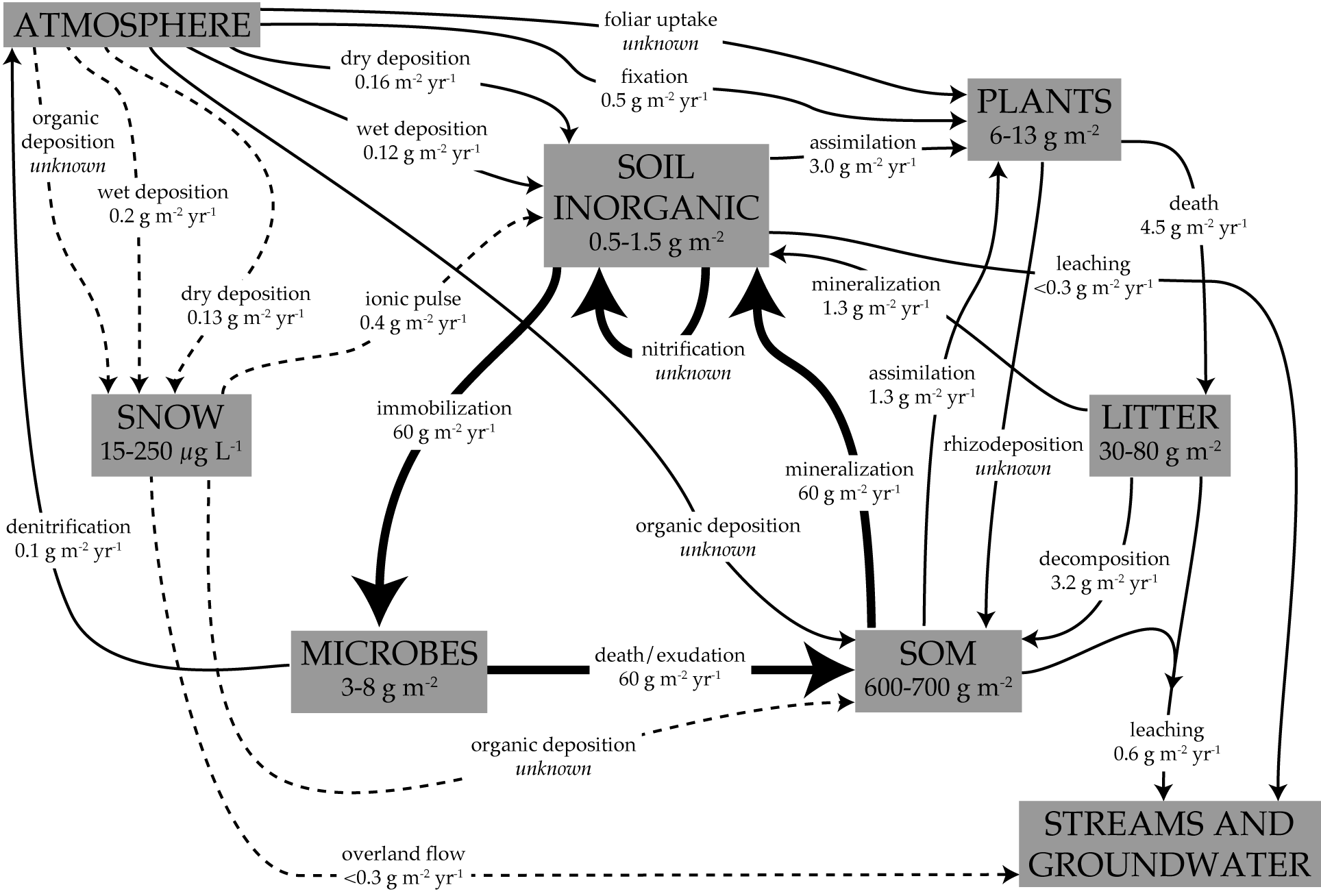
And if that is not complicated enough, each of these pools and fluxes can vary across the landscape! The snow survey will aid in our understanding how the SNOW box as well as the dashed arrows on the graphic vary across the landscape.
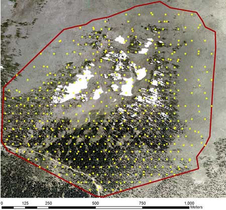
To create a map of snow depth across the watershed, a team of generous and friendly (heroic, really) volunteers and myself, will measure snow depth at each of 500 locations across the watershed using GPS units and depth-measurement poles. To make sure to get all areas, most of the 500 points will be laid out in a hexagonal grid, with ~40 m between each point. The grid will be spaced more widely in the alpine tundra since the snow depth will be less heterogeneous up there. The only shortcoming of the grid method is that it will not allow me to characterize the patterns of snow depth at scales smaller than the grid size. To help alleviate that problem, some of the locations are randomly chosen so that they will occur at various distances from the gridded points. With all of this taken into account, the sampling grid within the Soddie Watershed looks like this:
Finally, you might be wondering why I am interested in nitrogen inputs in the first place. The reason is that nitrogen deposition is an important environmental issue in mountain ecosystems. For example, on Niwot Ridge, nitrogen deposition is now about 10 times higher than natural levels. We have some idea of what this is doing in particular areas: for example, it can alter the plant species composition and acidify soils and waterways. But the landscape in this area is very complex and variable, so to totally understand what the nitrogen deposition is doing to the vegetation, soils, and waterways, we need to understand the spatial variation in nitrogen inputs and nitrogen processing. That’s basically the goal of my dissertation and this project is an important part of that.
I’m looking forward to the survey and I’ll post the results here shortly after it’s done! I know you’re all waiting with bated breath.
2 Responses to “Snow survey in the Soddie Watershed 2008”
This is going to be interesting.
By the way, your blog isn’t very Internet Explorer 7 friendly, not that it matters…
By Brian Seok on Mar 19, 2008
Hmm, that’s a bummer. I’ll look into it. I guess it kind of figures that open source WordPress and corporate behemoth Microsoft don’t play well together…
By Anthony on Mar 20, 2008